
The Ride
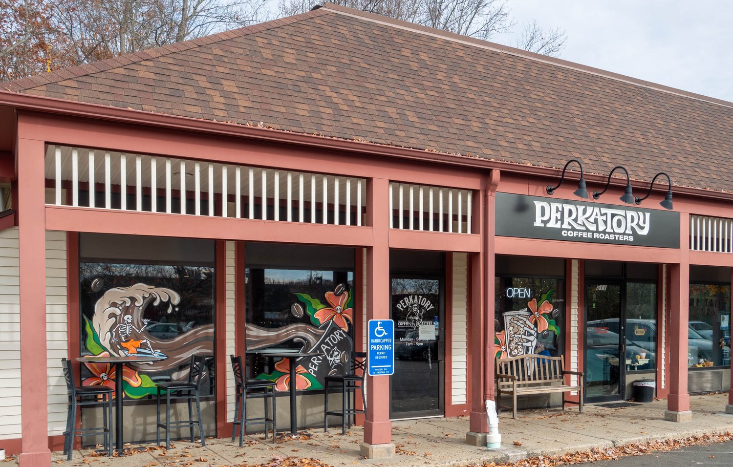
A brisk November Sunday morning greeted me as I prepared to depart for Perkatory Coffee Roasters in Branford, CT. With the temperature hovering right at freezing as I climbed aboard the BMW R1200GSA, I was glad to have wind protection and plenty of capacity for heated gear. I plugged the address for Perkatory Coffee Roasters into the Beeline App, which indicated 40.9 miles as the crow flies to my destination on the Connecticut coast. See our article on discovering new roads with Beeline.
Connecticut’s coast always makes me pause, not because it doesn’t have incredible sights along the way but because my sense of direction tends to get confused. I think the coast near Stamford is in the south, while New London is in the north. While technically this is true, the difference in north/south is roughly the same as Cross River to White Plains or about 15 miles. This incorrect preconception explains why I was surprised that the compass pointed east when I left.
Leaving Cross River, I headed east on Route 35 toward the Connecticut border, where I would enter Ridgefield, CT. Route 35 joins with Route 33 in Ridgefield, but the direction was misaligned with my eastern direction. With a slight diversion, I got onto Route 102 and headed east. This fun, twisty little road heads to Branchville when it ends at Route 7.
Route 7 is one of the larger roads in the area, connecting Danbury and Norwalk along a north/south line. Of course, I still needed to head east, so a quick north diversion on Route 7 got me to Old Redding Road, where I used to climb up the ridge on the eastern side of Route 7. This road also ends at a north/south road, but this time, I took Umpawaug a bit south to Diamond Hill Road, which headed east. Crossing Route 53, the road becomes Great Pasture Road and then joins Old Stagecoach Road before merging onto Route 107. As I headed past the Redding Town Hall, I turned onto Cross Highway since 107 turned north.
Cross Highway leads to one of my favorite roads in the area. The road follows along the Aspetuck River with several ponds and even some small waterfalls within view of the narrow, winding road. While the road itself is worth a ride, I’m more fascinated by the name Poverty Hollow Road. The area was settled in the mid-1700s, and the inhabitants struggled to earn a meager existence from the farms in the wilderness. People experiencing poverty in the area still struggled as the years progressed, going so far as for the name to stick in the early 1900s. In the greatest strike of irony, or perhaps good old gentrification, the area now has some of the most well-to-do people with home prices to match, despite the name suggesting more humble abodes.
As I headed east, I passed the Last Drop Coffee Shop, reviewed previously on Tank of Coffee, and continued toward Monroe, CT. As I approach the valley where the Housatonic River flows, the road begins descending. My route begins, following along the western bank of the river toward Shelton, CT. Unfortunately, I missed the turn to cross over the river into Derby and followed the road for a bit south before realizing I couldn’t cross the river for a while. I turned around and crossed the Housatonic into Derby, which acts as a twin city for Shelton, although Derby has more of a peninsula shape here as it is split on the other side by the Naugatuck River, which I cross to get onto Route 34 in East Derby.
Within a few miles, I enter the major city of New Haven and pass the Yale Bowl before I reach the downtown. With another body of water to cross, this time the Quinnipiac River, all roads encourage using Interstate 95 for the crossing, but I managed to avoid the highway with a parallel path on Route 1. But the compass is urging me to get onto the highway as Route 1 heads a bit south, urging more of a northeast heading. I pull off at the exit for Branford and navigate to the coffee shop less than 1/2 mile from the exit. There is plenty of parking, and I grab a spot close to the shop. Rever indicates the ride was 58.8 miles. Thankfully, the temperature had warmed up along the way and was now about 48F as I put the kickstand down on the GS. See the route below.