
The Ride
I climbed aboard the BMW R18 Classic and turned on the Beeline Moto at my Cross River, NY, starting point. I entered my destination for No. Six Depot Roastery & Cafe to the app, and it reported the straight compass distance was 74.6 miles. I knew it’d be a long ride as I was sure to hit many curves along the way, making my actual mileage longer than the straight line distance would suggest. See our article on discovering new roads with Beeline. A couple of riding buddies eager for good roads and coffee joined me.
With the compass pointing roughly north, we took Route 121 and headed north as we pulled out of the parking lot, and I led the small trio of bikes. I took it to the end, where it met Route 6 at a t-intersection by the East Branch Reservoir, providing water for NYC. I took a quick diversion on Route 6, heading east to get to Joe’s Hill Road, which, as the name suggests, winds its way to climb the hill overlooking the reservoir. It ends at Federal Hill Road near the northern edge of the reservoir, where I again turned east as the road crosses the border into Connecticut. The road descends to nearly meet Route 6 again, but I turned left to head north on Aunt Hack Road. The road splits the Richter Park Golf Course that overlooks the West Lake Reservoir, providing water to Danbury.
I continue north along some backroads until I reach Route 39, which heads north until just after it curves around Ball Pond and begins to head east. I take Warwick Road to join Route 37, which comes very close to the New York border as it heads to Sherman, CT, where it rejoins Route 39. I take it until it ends at Route 7, where I head north, passing Bulls Bridge.
Route 7 is a popular route with motorcyclists as it hugs the path of the Housatonic River. The gentle, winding scenic road is a beautiful way to head north while avoiding the major highways. I take it till I reach the covered bridge at West Cornwall, where I pass over the river and continue along Route 128. This covered bridge was closed for a while due to an accident that damaged it, so I was glad to see it reopened for my trip today.
Route 128 starts to head south, so I turn onto Cream Hill Road, which rewards me with some outstanding views of the farms on either side as it climbs up on the hills on the east side of the Housatonic River. The road ends at Music Mountain Road, which I take west for what feels like no time until it joins Lime Rock Station Road, which follows the old railroad line. Lime Rock Station Road joins with Route 7 when it crosses the east side of the Housatonic River, but I continue straight across Route 7 along Warren Turnpike Road, which leads to the charming Falls Village.
The compass indicates that about 25 miles remain in a straight line to West Stockbridge, MA, as we pass Falls Village, rejoin Route 7 in North Canaan, and cross into Massachusetts. Route 7 in this part of Massachusetts leads into Sheffield and Great Barrington, making it more densely populated. Traffic increases accordingly. It is still popular with motorcycles, and I see several of them as I enter downtown Great Barrington.
Great Barrington became part of the Gilded Age resorts once the railroad arrived in the late 19th century. The tracks for the Housatonic Railroad can still be found just west of Route 7 via Railroad Street, which leads to the original station. Passenger travel ended in the early 1970s, leaving the line to just freight today. The Arlo Guthrie song Alices Restaurant tells the story of Guthrie visiting friends in Great Barrington and nearby Stockbridge. Today, the Guthrie Center is based in the Old Trinity Church, which was the home of Ray and Alice Brock at the time of his visit. Alice Brock was the purveyor of the restaurant featured in the song’s title.
While I could have stayed on Route 7 to continue north following the compass indication, I’ve visited this part of western Massachusetts many times since childhood and still have a nearby family vacation home. I headed east on Route 23, heading toward Monterey and Otis. Once I reached Otis, I turned to make a loop around the Otis Reservoir. This road isn’t fast, about 25MPH, but the view and the winding turns are worth a little diversion. At Route 8, I turned north and continued on Route 20, which joined with Route 8 in West Becket, not far from the performing arts center of Jacob’s Pillow.
Route 20 leads to Lee as it follows closely to Interstate 90. I headed along Stockbridge Road till it joined Route 7, leading me up to Lenox, another town from the Gilded Age. Many of the mansions built there were no longer viable after the federal income tax was created in 1913. Some were torn or burned down; others were converted to properties used by large organizations. Tanglewood was the estate of the Tappan family and today is the summer home of the Boston Symphony Orchestra. The Mount, originally the home of Edith Warton between 1902 and 1911, is another of the grand estates in the area. Between 1978 and 2001, it was the base of the theater group Shakespeare & Company. Today, the Mount is a historic house focused on the author Edith Wharton and a frequent host of various literary events.
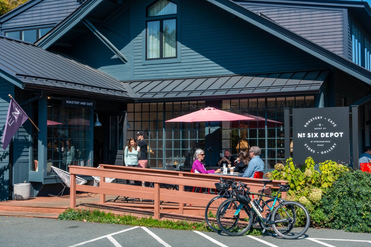
Shortly after passing Tanglewood, I arrived in West Stockbridge and pulled into the parking lot beside No Six Depot Roastery & Cafe. Rever reported I’d traveled 141.3 miles, so I hoped the coffee would be worth the long trek. See the route below.