
The Ride
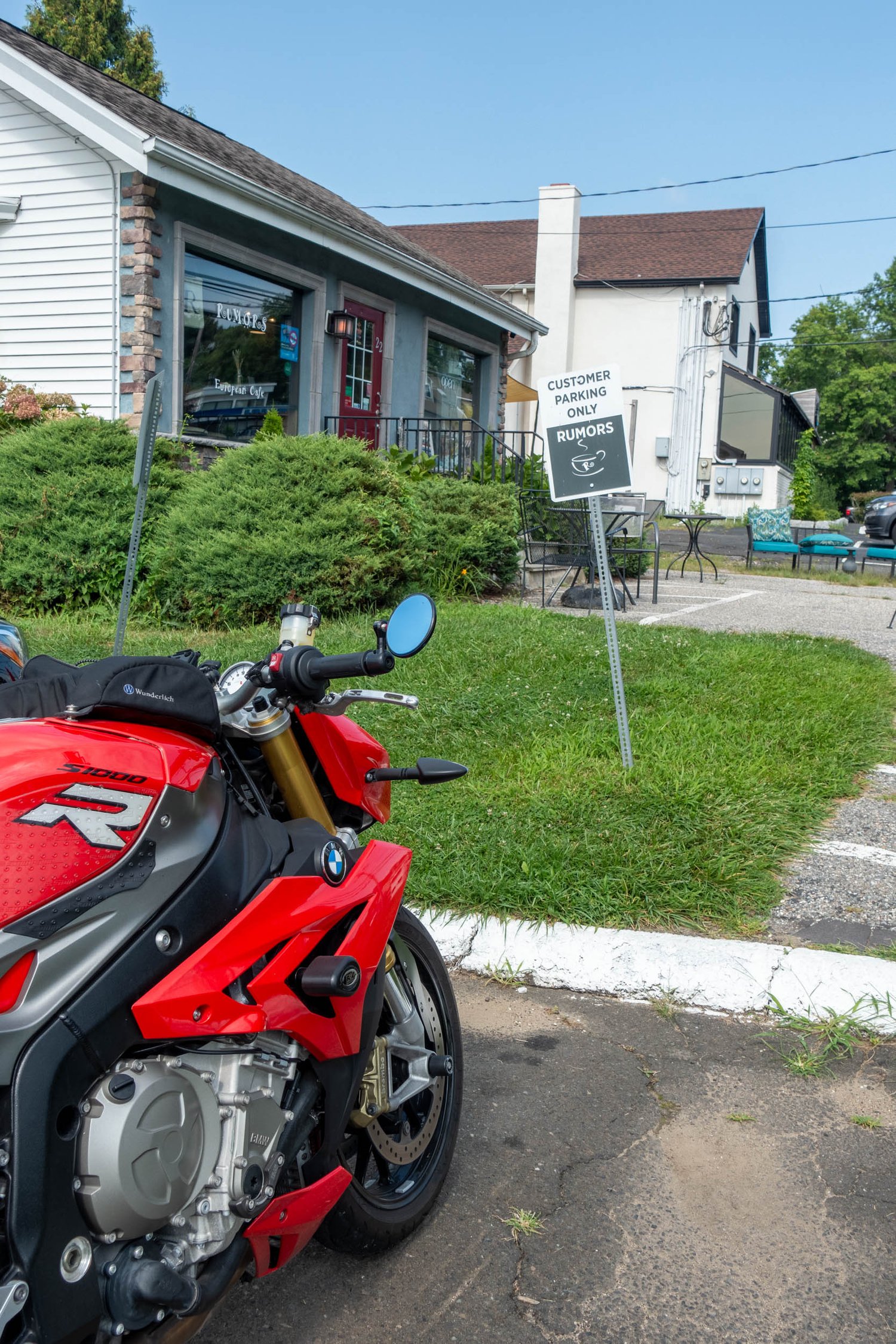
As I thumbed the starter on the BMW S1000R, the 999cc inline four roared to life at our start in Cross River, NY. The compass on the Beeline Moto shows just 10 miles to our destination in Danbury, CT. While a quick highway ride was possible, at Tank of Coffee, we always try to find the fun back roads to our coffee shops.
I headed north on Route 121 and turned right onto Chapel Road, a fantastic winding road leading to an old chapel just west of Lake Waccabuc. The road ends at the intersection with Mead Street, with the chapel on my left at the corner. I turn left to head north on Mead Street till it ends at Hawley Road.
I take this heading east, and it soon passes the Mountain Lakes Park, the northernmost county park with over 1000 acres of rugged terrain and five lakes to enjoy along the trails. Camping is also available.
As the road winds south, I pass through Twin Lakes Village, which sits between Lake Waccabuc to the west and Lake Rippowam and Oscaleta Lake to the east. I’m not sure why it’s not named Triple Lakes Village instead. Perhaps it only refers to Rippowam and Oscaleta?
The road ends at the intersection of Main Street, where I take it heading east, as that most closely aligns with Beeline’s compass indication. Truesdale Lake is right before I cross the border into Connecticut. The road begins to climb up the small ridge and takes on the name of West Mountain Road to reflect that.
The road starts to wind south, so I take a left onto Old West Mountain Road to stay aligned with the compass. It lets me out at Barrack Hill Road, which I take to Route 116, heading north. While 116 is a beautiful road in its own right, I know that it intersects with Route 121 a few miles up, so I turn off onto Sherwood Road to reach Ledges Road, running alongside a ridge.
Barlow Mountain Road sounds promising, so I turn onto that, passing Lake Naraneka on my right. It makes a sharp hairpin turn at a trailhead and climbs the hill. It concludes at Bennetts Farm Road, which also sounds promising, and a head east on that, as my compass is pointing north, and I have no matching roads to choose from until Mountain Road.
Unfortunately, this road ends up turning east and then finally south as it wraps around Wataba Lake. It’s a nice road, to be sure, but with no outlet from any of the roads breaking off from it, I make a couple of laps trying out options before staying on Bennetts Farm Road, which heads south and then turns east as it descends to join Route 7.
While Route 7 is a major road, it is aligned to head north, matching my compass. I pass Danbury Municipal Airport, one of my favorite local airports to fly into. With all the hills surrounding it, your approach to the east/west runway that the winds tend to favor has you flying a map of the earth as you descend, crossing Route 7 to the runway. It’s a unique approach, while the other runway often has you following route 7 in the valley between the two ridges. Both can be a fun challenge & many students take advantage of the flight schools on the field.
Just past the airport is Danbury Fair Mall and the intersection with Interstate 84. I stay to the right to avoid the highway and get onto Mill Plain Road, which leads me directly to the coffee shop on my left.
Arriving in the Rumours parking lot, Rever reports that we had traveled 29.4 miles, so I found the long way to this coffee shop. See the route below.