
The Ride
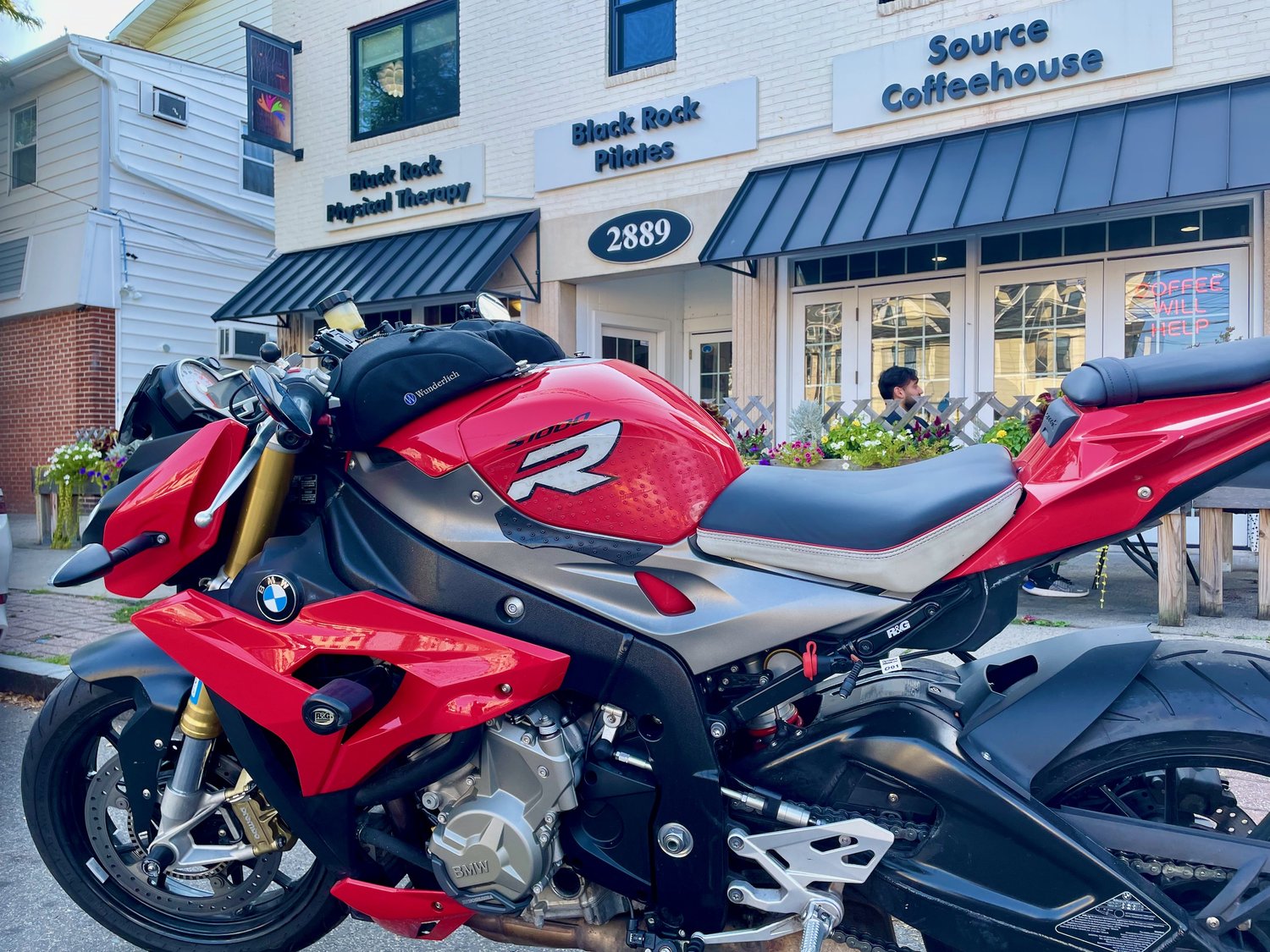
It’d been a while since I’d taken the BMW S1000R out for a coffee ride, so I pulled it out of the garage this morning for my journey to Source Coffeehouse in Bridgeport, CT. The Beeline Moto compass pointing at the coffee shop indicated 21.2 miles as the crow flies from my start in Cross River, NY. See our article on discovering new roads with Beeline.
With the compass pointing roughly southeast, I headed east on Route 35 toward Ridgefield, CT. Just past the border, I turned off Route 35 onto a side street heading further south. However, it turned back, heading west, crossing me back into New York, so I grabbed the next road heading south. This road ended at Route 123, so I was back on a faster road winding its way south. I crossed back into Connecticut near Vista, NY, and entered New Canaan.
While Route 123 is a lovely winding road, the Beeline Moto urged me to find a way to head further east, so I turned onto what seemed like a promising road called Canoe Hill Road. I took it to where it joined Route 106 leading to Silvermine Road.
These backroads proved to be excellent winding roads, but as I approached the Merritt Parkway/Route 7 interchange, the option for roads that matched the compass headed wasn’t there. I ended up with a zig-zag crossing back and forth over the Merritt Parkway and some residential streets, which seemed to all end in cul-de-sacs. I finally ended up on Route 1 just east of Norwalk, and given it aligned with the compass, I took it heading east.
Route 1 is often called Post Road or sometimes Boston Post Road—Interstate 95 runs parallel to Route 1 along much of its run, especially in Connecticut. While I95 is one of the oldest interstates in the country, Route 1 was the main road to Boston before the Interstate was built. That history explains why the road is primarily commercial buildings along the sides with lots of traffic today. It’s not the most fun road for a motorcycle, but it was nearly perfectly aligned with the compass.
Along Route 1, I passed through Westport, Southport, and Fairfield, CT. However, when the road turned north to parallel the Interstate, I took Route 130, which aligned with the compass and showed less than a mile to go. This route had me crossing the Rooster River and entering the Black Rock Historic District of Bridgeport, CT. A handful of blocks past the river, I found the Source Coffeehouse.
As I pulled in front of Source Coffeehouse, I realized that I’d left my backpack on the floor of my garage, so I had to make do with just my phone taking pictures for this visit. As I stopped the recording on Rever, it showed that my route was 33.2 miles. See the route below.